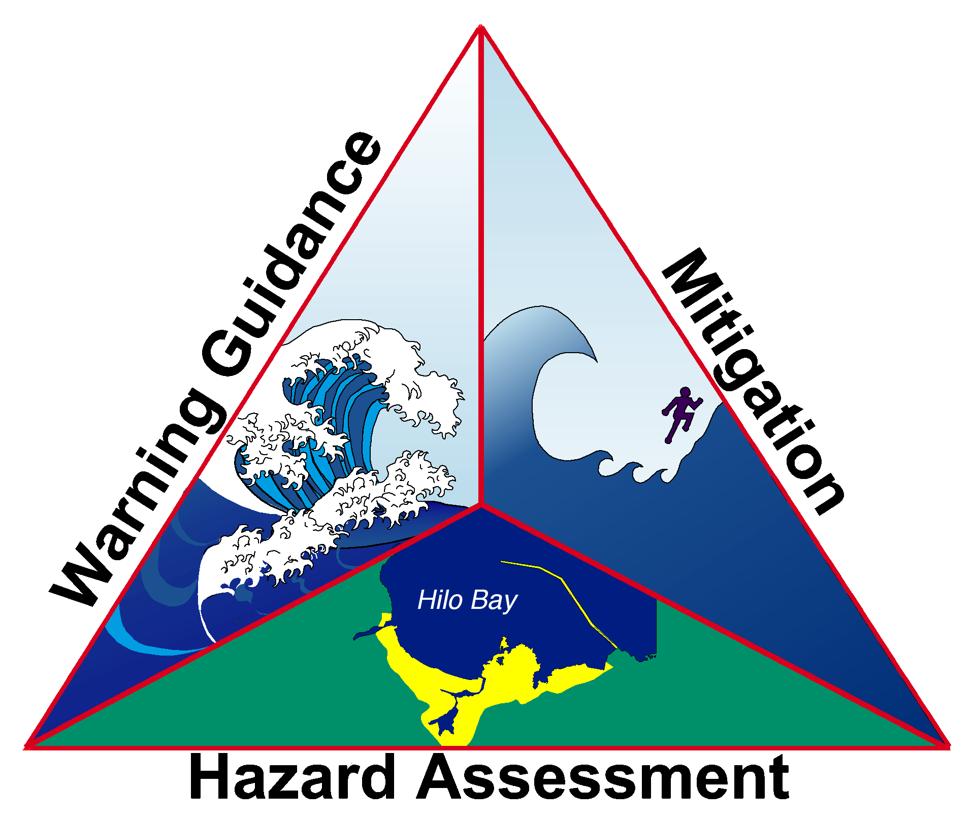
From federal fiscal year 2008 through 2017, NOAA has invested or approved investment for a total of 17 prime and 38 subaward recipients who work to fulfill the NTHMP mission "to mitigate the impact of tsunamis through public education, community response planning, accurate hazard assessment, and inform the warning process."
NOAA's National Weather Service is pleased to announce $5,892,849 for projects and support to make coastal communities throughout the United States and its territories safer from tsunamis. ($5,999,580 was committed, but some grants were reduced during application review when more information and details indicated lower costs due to more precise cost estimates, changes in some applicant's indirect cost rates, and recalculation of some grant requests after resolving mathematical errors.)
FY17 NOAA/NWS Tsunami Financial Assistance grants for the performance period from September 1, 2017, through August 31, 2018 or 2019, have been awarded to 12 prime recipients and 13 subaward recipients to support these tasks:
| Grant Recipient |
Activity |
| Alaska Department of Homeland Security and Emergency Management Subawardee:
University of Alaska/Fairbanks [UAF] |
|
[Prime] Administer the state tsunami grant.
|
|
[UAF] Representation by UAF Geophysical Institute staff in the Alaska Tsunami Preparedness and Hazard Mitigation Program. Demonstrate conformity of the Alaska landslide-generated tsunami model with the standard of accuracy at the forthcoming landslide modeling workshop.
|
|
[Prime and UAF] Participation by Emergency Management and Science Members of the NTHMP Coordinating Committee in NTHMP annual and subcommittee meetings and Landslide Workshop.
|
|
[UAF] Compilation and publication of the technical report for Haines, Skagway, Homer, and Seldova.
|
|
[Prime] Conduct two-and-a-half day workshop that discusses the science of tsunamis, local threat, preparedness, warning and alerting procedures, as well as response and recovery for community leaders and local emergency managers.
|
|
[UAF] High resolution modeling and mapping Adak and Atka (verification of the approximate Tsunami Hazard Boundary Zone developed in the FY14 period) |
|
[Prime] Provide training for maintenance and support of tsunami sirens systems across Alaska.
|
|
[UAF] Approximate tsunami hazard boundary zone for six highly threatened communities in non-mapped coastal regions of Southeast Alaska.
|
|
[UAF] Tsunami Current Modeling at Places of Refuge near the communities of Chenega Bay and Tatitlek.
|
|
[Prime] Installation of a warning siren system in Kasaan.
|
| American Samoa Department of Homeland Security |
[Prime] Support 3 positions: NTHMP Tsunami Program Administrator, Project Coordinator, NTHMP Liaison.
|
|
[Prime] Participation by Emergency Management Member of the NTHMP Coordinating Committee in NTHMP annual and Mitigation & Education Subcommittee meeting. Science member for American Samoa is a NOAA employee and is ineligible for grant-funded travel.
|
|
[Prime] Tsunami full scale exercise -- involvement of all the multiple agencies, organizations, and jurisdictions to test the Amercan Samoa Government Territorial Emergency Operations Plan in a real-time, stressful environment that is intended to mirror a real incident.
|
|
[Prime] Tsunami Outreach & education - Tsunami Preparedness Week, evacuation drills and tsunami exercises, workshops and training.
|
|
[Prime] Signage replacement, billboards, Siren System Health Audit.
|
| California Office of Emergency Services Subawardees:
California Geological Survey [CGS]
Humboldt State University [HSU]
University of Southern California [USC] |
[Prime, USC] Tsunami Preparedness: Continue local outreach, workshop, training, exercise activities. Two state tsunami steering committee meetings. Continue to develop Tsunami Inundation Map Information Sheets and Vulnerability Sheets. Coordinate and collaborate with USGS and other NTHMP partners. Support Tsunami Preparedness Week through subaward to University of Southern California.
|
| [CGS] Inundation and Evacuation Zone Improvements. Complete a single maximum tsunami inundation map for 100% of the state; Meetings and workshops with local communities to get feedback for maps in their jurisdictions; Develop inundation maps, evacuation maps, and sign placement plans for Lake Tahoe; Develop inventory database of existing offshore landslides and run slope-stability models.
|
| [Prime and CGS] Update Tsunami Evacuation Response Playbooks statewide; Exercise the use of the Playbooks in cooperating counties and the NWS WFOs; Work with NOAA, Hawaii, the USVI, American Samoa, and other states on protocols for the FASTER method for enhanced inundation data.
|
| [Prime and HSU] Ongoing TsunamiReady support to assist in filling roles supporting communities becoming TsunamiReady; Increase Tsunami Warning Signs along coastal California; continue to explore TsunamiReady status for additional communities, harbors, and geographical areas; Continue support of Redwood Coast Tsunami Work Group.
|
| [CGS] Maritime planning and preparedness: develop maritime safety products; update outreach materials to address movement of watercraft in a tsunami emergency; martime response playbooks.
|
| [Prime and CGS] Participation by Emergency Management and Science Members of the NTHMP Coordinating Committee in NTHMP annual and subcommittee meetings.
|
| Commonwealth of Northern Mariana Islands |
[Prime] Procure and implement a tsunami warning system for all communities on the western coast of Saipan
|
|
[Prime] Develop new tsunami hazard products to assist the maritime community.
|
|
[Prime] Continue to support integrating tsunamis into K-12 education; support tsunami outreach efforts to specific audiences; develop tsunami outreach products, especially for tourist and business communities.
|
|
[Prime] Support and integrate tsunami preparedness into training and exercise programs.
|
|
[Prime] Purchase and replace tsunami signage for the island of Saipan, Tinian, and Rota.
|
|
[Prime] Participation by Emergency Management Member of the NTHMP Coordinating Committee in NTHMP annual and Mitigation & Education Subcommittee meeting. Science member for CNMI is a NOAA employee and is ineligible for grant-funded travel.
|
East Coast
University of DelawareSubawardee:
University of Rhode Island [URI] |
[Prime + URI] Development of estimates of tsunami return periods; considering additional types of tsunami sources, such as meteotsunamis. Continue work on estimation of return periods of extreme tsunamis from various sources used in inundation mapping with emphasis on landslide and meteo-tsunamis.
< |
| [Prime + URI] Simulation and evaluation of meteotsunami hazard. Apply modeling methodology being developed in FY16 to simulating the propagation and coastal impact of meteotsunamis generated on the wide EC shelf, for events of 100-200 year return period.
|
| [Prime] Participation by Science Member of the NTHMP Coordinating Committee in NTHMP annual and subcommittee meetings and Landslide Workshop. East Coast Emergency Management member is not an employee of the grant recipient and is ineligible for grant-funded travel.
|
| Guam Department of Homeland Security and Emergency Management Subawardee:
University of Hawaii [UofH] |
[Prime] Tsunami Specialist position (1 FTE)
|
| [UofH] Mapping & modeling for Tumon Bay and Agana Bay
|
| [Prime] Create a one stop shop for all Tsunami outreach materials, hazards and risks references (web-based product)
|
| [Prime] Print 30,000 tsunami evacuation maps and conduct outreach.
|
| [Prime] Continue Tsunami Preparedness Outreach and Community Education Campaign; print 50,000 copies each of Guam tsunami brochure, evacuation wheels, Tsunami Ready cards and Tsunami Mikenna poster.
|
| [Prime] Collaborate with CNMI partner and take part in the Pacific Region Tsunami Work Group.
|
| [Prime] Participation by Emergency Management Member of the NTHMP Coordinating Committee in NTHMP annual and Mitigation & Education Subcommittee meeting. Science Member is a NOAA employee and is ineligible for grant-funded travel.
|
Gulf of Mexico
Texas A&M University at Galveston |
[Prime] Two tsunami inundation maps for Gulf of Mexico.
|
| [Prime] Submarine Landslide Characterization along the northern margin of the Yucatán Peninsula according to USGS.
|
| [Prime] Temporal-low-order inundation maps for tsunami hazard areas (communities) where inundation studies have not yet been assigned/executed or where little bathymetric and elevation data exists.
|
|
[Prime] Participation by Science Member of the NTHMP Coordinating Committee in NTHMP annual and MMS subcommittee meetings. Gulf Coast Emergency Management Member is not an employee of the grant recipient and is ineligible for grant-funded travel.
|
| Hawaii Emergency Management Agency Subawardees:
University of Hawaii [UofH] Pacific Tsunami Museum [PTM] City and County of Honolulu [CCH] |
[Prime] Administer tsunami grants. Sustainment of current activity, and manage and provide oversight for all NTHMP tsunami funds/projects.
|
|
[Prime] Outreach to develop statewide tsunami resilient and support for TsunamiReady/Storm Ready/HHARP activities i.e. new development and communities' renewal activities.
|
| [Prime] Prepare broadcast messages for use on foreign language radio stations throughout Hawaii.
|
|
[CCH] Provide evacuation signage on the southern shore of Oahu, evacuation directional road signs, and safe/refuge area signs.
|
|
[UofH] Mapping & Modeling Nawiliwili Harbor and Port Allen Kauai. Develop new tsunami hazard products to assist the maritime community and meet Emergency Management and other NTHMP customer requirements.
|
| [UofH] Tsunami Observer Program. Educate and train a group of volunteers across the State of Hawaii in real time data collection and post-tsunami field survey data collection methods.
|
|
[PTM] Support for Pacific Tsunami Museum in Hilo, Hawaii. This museum is the most active in conducting tsunami outreach and education for both residents and visitors of the state.
|
| [Prime and UofH] Participation by Emergency Management and Science Members of the NTHMP Coordinating Committee in NTHMP annual and subcommittee meetings and Landslide Workshop.
|
| Oregon Department of Geology and Mineral Industries (DOGAMI) Subawardee:
Oregon Office of Emergency Management [OEM] |
[Prime and OEM] Community-based outreach by DOGAMI and OEM. Conduct grass roots, community based outreach and education. Support for staff time at both DOGAMI and OEM, including one FTE position. Participation by Emergency Management and Science Members of the NTHMP Coordinating Committee in NTHMP annual and subcommittee meetings.
|
| [Prime and OEM] Outreach and education. Support for DOGAMI to give talks and meet with community leaders plus support to OEM for an outreach coordinator to facilitate and coordinate community outreach programs. Maintenance of the Tsunami Clearinghouse website. Installation of "Entering-" and "Leaving Tsunami Hazard Zone" signs. Evacuation Map sign design and purchase.
|
| [Prime and OEM] Evacuation difficulty analysis of Southbeach in Newport; Produce a "Beat the Wave" map brochure template for public use; Tsunami evacuation wayfinding for up to 3 communities.
|
| [Prime] Data consolidation and archival, geodatabase production, and development of time history stations for the Columbia River; Complete Columbia River journal article.
|
| [OEM] Oregon Tsunami Symposium: A three-day tsunami symposium to be held on the central coast to bring the latest scientific, preparedness, mitigation and recovery information to the coastal stakeholders. The audience will be public officials, policy-makers, emergency responders, emergency managers and non-profits agency representatives.
|
| [Prime] Develop wave arrival map layers central to northern Oregon coast.
|
| Puerto Rico Seismic Network (PRSN) Based at the University of Puerto Rico at Mayaguez Subawardee: Puerto Rico State Emergency Management Agency |
Note: due to the devastating impacts of Hurricanes Irma and Maria, some planned activities with FY17 grants may be changed at the discretion of the grant recipient and with NOAA's understanding and flexibility. Activities reported below describe pre-hurricane planned work.
|
| [Prime] State and Local TsunamiReady Program implementation and maintenance: 1) Support all communities whose TsunamiReady recognition is expiring within the grant year to renew; 2) Offer tsunami workshops; 3) Keep the TsunamiReady inventories up to date. 4) Update the PR tsunami media toolkit and the Tsunami Decision Support Tool. 5) Organize and participate in educational events throughout Puerto Rico.
|
| [Prime] Threat and hazard assessments in ports & harbors. Continue the tsunami and currents impact study in the ports of Arecibo and Guánica; extend the tsunami evacuation pedestrian analysis to the complete West coast municipalities (Aguada, Rincón, Añasco and Cabo Rojo); analyze the regional tsunami potential from volcanic sources; keep GIS database updated.
|
| [Prime & PRSEMA] Participation by Science Member and Emergency Management Member of the NTHMP Coordinating Committee in NTHMP annual and subcommittee meetings. |
| [Prime] Tsunami Exercise support and EMWIN systems. Coordinate a full-scale Caribe Wave tsunami exercise.
|
| [Prime] Outreach: Continue the education program on tsunamis through the partnership with the Puerto Rico Broadcasters Association.
|
| U.S. Virgin Islands Territorial Emergency Management Agency (VITEMA) |
Note: due to the devastating impacts of Hurricanes Irma and Maria, some planned activities with FY17 grants may be changed at the discretion of the grant recipient and with NOAA's understanding and flexibility. Activities reported below describe pre-hurricane planned work.
|
| [Prime] Tsunami maps reflecting model results: Evacuation maps to identify all modes of evacuation as well as modes that persons at risk would utilize intuitively. These maps will be prepared following current NTHMP/MMS guidelines for mapping and modeling.
|
| [Prime] Tsunami Readiness Program Coordinator for one year to: execute budget and personnel actions; ensure coordination of all tsunami grant activities throughout the performance period; verify activities through execution of projects and completion of activity reports.
|
| [Prime] Blue Line Project: Paint thermoplastic tsunami signage directly on the roadway at the line demarking the evacuation zone.
|
|
[Prime] Siren maintenance: Provide for maintenance of the existing sirens, complete all procurement procedures; complete maintenance activities as needed.
|
|
[Prime] Participation by Emergency Management and Science Members of the NTHMP Coordinating Committee in NTHMP annual and subcommittee meetings.
|
| State of Washington Division of Emergency Management Subawardee:
Washington Department of Natural Resources (DNR) Subawardee:
University of Washington (UW)
|
[Prime] Support one FTE position as Tsunami Specialist.
|
|
[Prime] Parts, maintenance, and satellite time for coastal tsunami sirens.
|
|
[Prime] Purchase and install two tsunami sirens to fill gaps.
|
|
[Prime] Install New tsunami evacuation and/or hazard zone signs in tsunami threatened communities and replace signs that have been damaged or stolen.
|
|
[Prime] Continue to develop outreach material and support the reprints of tsunami public education materials.
|
|
[Prime] Complete at least two public Townhall meetings; participate in at least one Tsunami Evacuation Drill; conduct at least one workshop for the hospitality industry.
|
|
[DNR] Continue production of bi-monthly TsuInfo Alert newsletter.
|
|
[UW] Project Safe Haven report: Review lessons learned from the Ocosta Elementary School project and the Long Beach berm project, reaffirm site location viability and conduct community outreach.
|
|
[DNR] Publish L1 inundation and current velocity model results for the Washington outer coast, Strait of Juan de Fuca, and northern Puget Sound.
|
|
[UW] Conduct a tsunami hazard assessment (THA) modeling study of Bainbridge Island and, in collaboration with PMEL, a Comparative Study of the GeoClaw and MOST model results.
|
|
[UW] Conduct a tsunami hazard assessment (THA) modeling study of the Whatcom County to Vancouver, BC region
|
|
[DNR] Complete Pedestrian Evacuation Modeling for areas of at-risk population in along the Strait of Juan de Fuca or northern Puget Sound based on Cascadia Subduction Zone Modeling.
|
|
[Prime and DNR] Participation by Emergency Management and Science Members of the NTHMP Coordinating Committee in NTHMP annual and subcommittee meetings.
|
|
[Prime] Partner with relevant federal, state, tribal, and local partners to deliver NOAA Weather Radio Training.
|
| Intra-NOAA Transfers to support NTHMP Activities NOAA entities may not bill states for services paid by grant funds. $629,552 in intra-NOAA transfers cover costs to NOAA entities for NTHMP partner support listed to the right.
|
[PMEL] Conduct two tsunami hazard assessment (THA) modeling studies for Bainbridge Island and Seattle to Everett Coastline. Work to be performed by NOAA's Pacific Marine Environmental Laboratory (PMEL) to support the State of Washington.
|
|
[PMEL] Tsunami modeling for ports and harbors of the U.S. Virgin Islands, including production of digital data and maps. Briefings of USVI officials to interpret modeling products and resources. Work to be performed by NOAA's Pacific Marine Environmental Laboratory (PMEL) to support the Government of the U.S. Virgin Islands.
|
|
[NCEI] Four Digital Elevation Models determined by NTHMP's Mapping and Modeling Subcommittee as priorities to be developed by NOAA's National Centers for Environmental Information (NCEI).
|
More Information
For questions on activities listed above, please contact the respective Principal Investigators, noted here.
For general information about NOAA/NWS Tsunami Financial Assistance Grants, contact:
Rocky Lopes
NTHMP Program Administrator
NOAA/National Weather Service, Tsunami Program
1325 East West Highway, MS AFS26
Silver Spring, MD 20910
(301) 427-9380
nws.tsunamigrants@noaa.gov
|